Home Back to the contents links Previous page On to the next page
© 1972 Geoffrey Goreham
The land here formed part of the Aspland House estate, an early 19th century mansion house, the grounds extending from what is now St. Matthew's Road the Thorpe Road. This residential building followed the construction of Riverside Road in the 1890s from what was then an old tow-path along the river edge.
In 1885, Isaac Bugg Coaks, a Norwich Lawyer, sold part of the Hill House estate to the School Board of Norwich for a new school building, and for the construction of a number of new roads to be named Elia, Marion, Beatrice, Florence, Ethel, and further north, Primrose, the roads being the christian names of his six daughters. The Hill House Estate, partly wooded and covering an area of some 14 acres was located on the sloping ground north of the Rosary Cemetery and south of St. Leonard's Road from Rosary Road to the junction with Quebec Road. Hill House, built of grey-brick in the early 19th century is situated on the south part of the estate and can be seen quite dramatically from Florence Road.
In the same area another private estate, known as Grove House was purchased for residential purposes in the early 1900s. The frontage of this estate was developed as large terrace house building and Matlock Road was constructed as a new highway through the centre of the area.
Along Cotman Road, Heathside Road and Ranson, Road, which form the anatomy of the road system on these slopes, a few houses were built in the period between the wars but development has generally been slow. The demolition of "Fernhill", a large Victorian house off Cotman Road in 1961 made available an area of land for residential development and further building in this part of Thorpe Hamlet is scheduled.
Typical modern housing can be seen at the junction of Cotman Road and Telegraph Lane East where part of the grounds of "Heathside" have been taken over for private building later continued along the Ranson Road side of the garden area.
STANLEY AVENUE AND RESIDENTIAL DESIRABILITY
South of Lion Wood, Stanley Avenue, forming a loop from Thorpe Road to Harvey Lane, was constructed in the early 1870s and remained largely undeveloped for 10-15 years. In the 1890s some terrace houses were built at the corner of the avenue on the south side, and on the north side in the woods a large, detached villa, known as "Brackenbrae" was built in 1892 (now destroyed).
Much of the subsequent development occurred on the south side in the 1930s towards Harvey Lane. Opposite on the north side some post-1945 houses completed the present pattern of development.
Stanley Avenue is a good example of the kind of residential development that shaped the geography of Thorpe Hamlet. At first, as can be seen in the houses along Thorpe Road, the desirability of living in Thorpe Hamlet appealed to the more wealthy citizens seeking to escape from the crowded city parishes and many of the early 19th century houses stood isolated and imposing, in Gothic splendour, usually with fine views of the river and the surrounding countryside. As the Hamlet became more developed, the terraced house builders moved in and soon created their chimney pot landscape on the more accessible land. Some areas, of course, escaped the early scramble for building land such as the Mousehold estate. Situated centrally within the boundaries of Thorpe Hamlet this estate covered an extensive area of woodlands and open fields roughly bounded by Plumstead Road, Thorpe Road, Telegraph Lane and Harvey Lane. Since much of the late 19th century development was concentrated to the west and south, this large estate remained almost intact until 1930.
The geology of the land in Thorpe Hamlet consists mainly of chalk, clay, sand gravel and brick earth. The chalk hills, situated to the west and rising steeply above the river, were frequently worked out for lime burning before any residential development. Several pits were formed, and one of these, Lollard's Pit, became notorious in the 16th century as a place for the burning of heretics.
Another large pit off Rosary Road was laid out as a football ground in 1908, the area around the slope still containing many old worked out chalk tunnels which were to be used from the earliest times for stabling, storage and even as an air raid shelter during the second world war. It is said that some of the material taken from these chalk workings was used in the building of Norwich Cathedral in the 11th century.
Rosary Cemetery was established in 1821 on land formerly in use as a market garden, and presents a broad green open space between the housing areas to the south and the playing fields of the Telegraph Lane schools to the north. The 13 acres of the cemetery came under the control of the Norwich Corporation in 1954 and it is estimated that about 18,500 people have been buried there since 1821.
By 1907, with the population of Thorpe Hamlet reaching 7,000, a new church was built at the junction of Kett's Hill and Plumstead Road. The building of St. Leonard's followed some early 1900 residential expansion along Plumstead Road, Belsize Road and Britannia Road. Not a very attractive building, it lacks the comfortable solidity which characterised this kind of church building in this period. Its appearance suggests a temporary structure which was further emphasised when part of its grounds with its trees and shrubs disappeared during the widening of Kett's Hill in the early 1960s.
With the building of the Pilling Park Housing Estate and the Heartsease Housing Estate in the 1930s and 1950s, the importance of Kett's Hill as a main traffic link road became a matter of some necessity and in 1959 a two stage scheme to widen the hill was carried out. Many old Victorian houses on the south side of the hill, which were built in the 1880s, were demolished and a roundabout was constructed at the Barrack Street junction on the site of a vicarage in 1954.
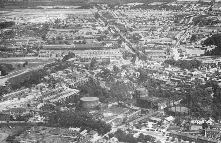
Illustration © Aerial view looking north over the old gasworks
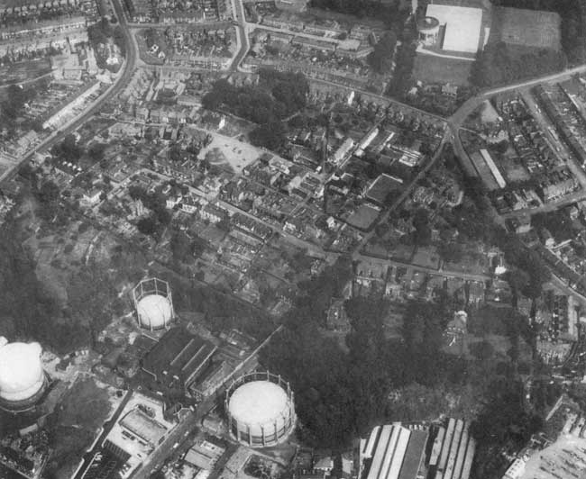
Illustration © Aerial view of Camp Rd and Gas Hill area C1962
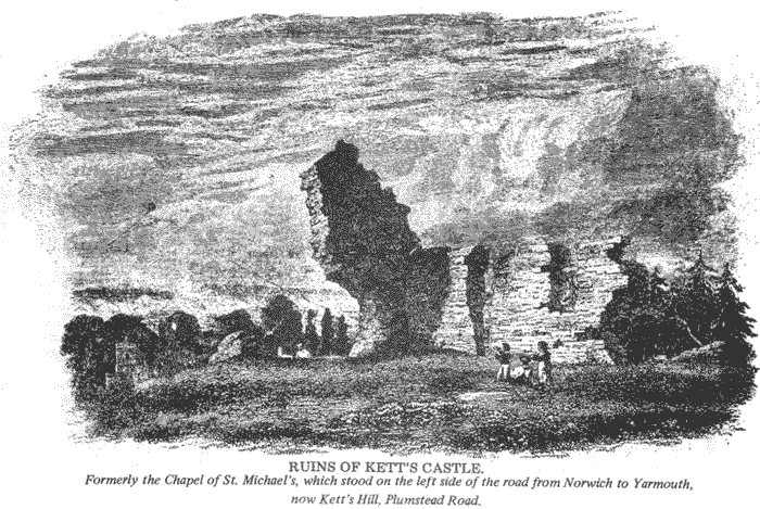
Illustration © Ruins of Kett's Castle
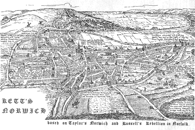
Illustration © Kett's Norwich an annotated sketch map
© 1972 Geoffrey Goreham
Home Back to the contents links Previous page On to the next page